Welcome to PrimeThought Software Solutions SpatialBase
SpatialBase is the most advanced GeoSpatial Database extension for Microsoft SQL Server.
SpatialBase builds on the first ever 3D extension developed for SQL Server and takes it to a whole new level.
SpatialBase
Support for 2D and 3D Spatial objects
Not only is there complete support for 2D and 3D Spatial objects, SpatialBase provides sophisticated spatial operations like 3D booleon operations, on the fly surface building, on the fly contouring and heat mapping straight off and in the database.
In addition SpatialBase provides a complete set of Mining Objects, allowing a secure transacted environment for all your mining data.Objects supported include boreholes, ramps, pit designs, Histograms, Variograms and Variogram models.
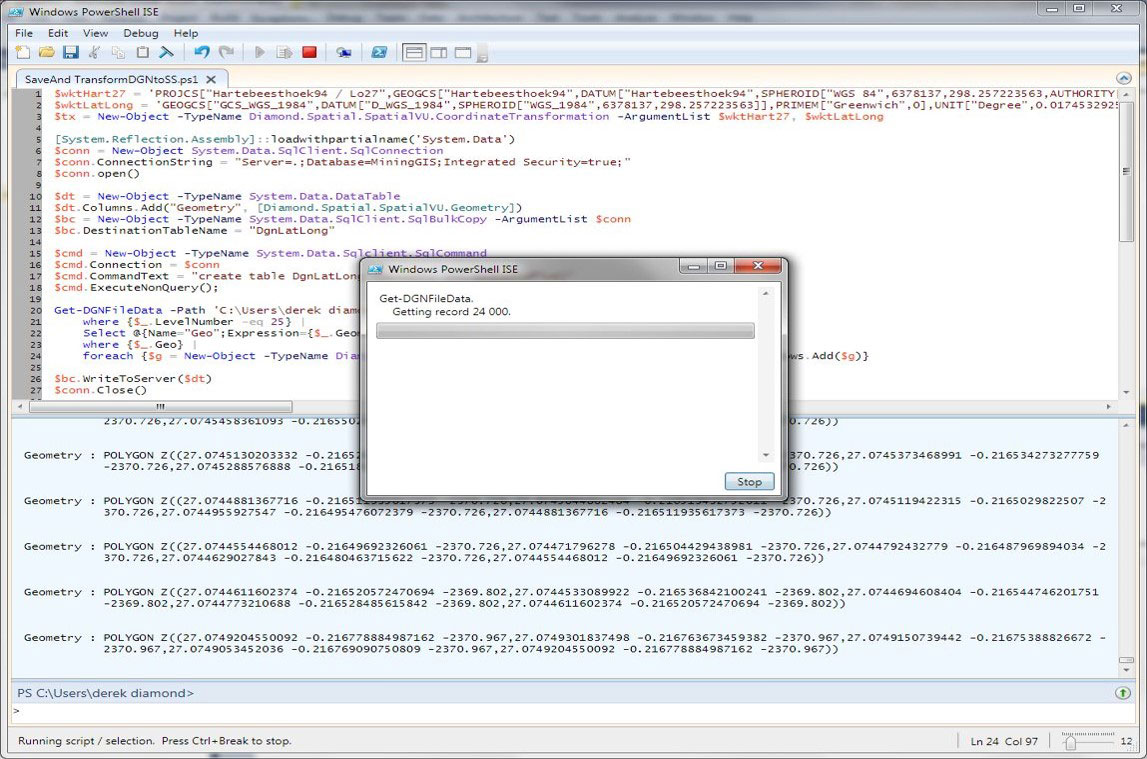
SpatialBase allows for on the fly borehole desurveying in the database using its native Borehole object. SpatialBase provides the most advanced and enterprise environmnent for storing and processing geoSpatial, Mining and Engineering objects.
SpatialBase
Salient Features
- OGC Compliant Spatial Database Extension including full 3D with operations
- Ability to import from standard spatial formats like Shape Files, Microstation design files, AutoCAD dwg and DXF files all WITH attributes.
- Build colour/thickness/Style thematics right from the database
- Support for advanved mining objects like BoreHoles, Ramps, Pit Shells, Workplaces etc.
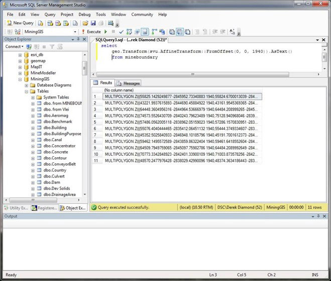
- Support for Helmert and affine transforms right in the database.
- Support for all projections. Project on the fly from Lat/Long to local LO in the database
Click here to see our mining suite presentation
SpatialBase is used successfully by the following professions:
- Mining Professional – Reporting
- Mining Data Specialist
- IT Specialist
- Software Developer – Mining
- Database Administrator – Mining
- Mineral Resource Manager
- And more…